Photo Tour: Walks Around Berlin
What can I say about Berlin in just a few paragraphs -- or show about it in just a few photos (after only a week here... on my first visit)? It's a huge city, about 50 km (30 miles) across, with incredible change happening everywhere, over and over again for the past century. Berlin was ripped apart by World War I and by the peace treaty, its cultural essence (and many of its people) destroyed by the Nazis, bombed into rubble during World War II, and cut in two by the Soviets. Through all of that, Berliners have survived and thrived and rebuilt (and rebuilt...). Even today (September 2003), nearly bankrupt, Berlin is rebuilding itself -- and its peoples' vibrant lives go on.
I met some of those people during my visit: the dignified and gracious owner of the bed & breakfast where I stayed (a former flight attendant for Air France who also happened to be gay), a newspaper reporter, my walking tour guide... all of whom moved to this city from somewhere very different and stayed because they loved its vitality, its diversity, and its differences from the rest of Germany.
I did a lot of walking: with an all-day walking tour, also by following routes in my guidebook, and by wandering on my own. Here are a few of the zillions of photos I took. (There are more on the following pages.)
To get a larger version of any picture, click on it; a new window
should open. When you close that window, this window should still be
here.
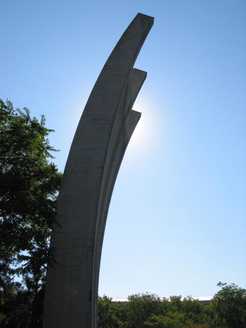
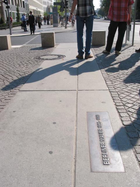
At the left below is the Luftbrückendenkmal, a huge monument to the Berlin Airlift. After WWII, the western sectors of Berlin were an island in the middle of East Germany.When the eastern government tried to blockade the western part of the city (breaking the three rail and road links that were the city's lifelines, symbolized by those three prongs), pilots from the West flew one plane every 90 seconds for almost a year to keep West Berlin alive. The East German government eventually ended the blockade and went on building its socialist society... while the West went a different way, rebuilding its part of Berlin into a capitalist city with virtually no unemployment. Citizens of the East voted with their feet and fled to the West in huge numbers until the eastern government decided to stop the refugees. At 1 AM one night, barbed wire went up, separating families from each other. It was followed by several versions of the Berlin Wall, each stronger than the last one -- eventually becoming two walls, with a "death strip" no-man's land between. Most of the wall came down in 1989, but the path of missing parts is now marked by a line of bricks -- and, near the Brandenburg Gate (which was between the walls), the concrete marker at the right below:
|
||
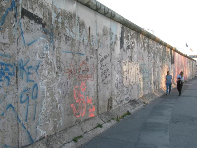
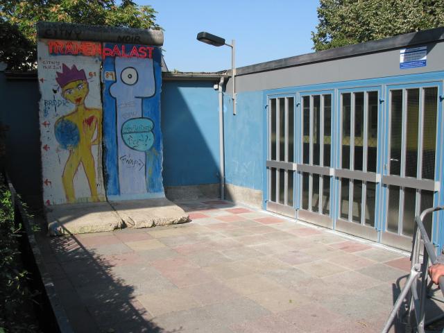
After the Wall was finally broken in 1989, parts of it were moved around the city (and around the world) -- and many were painted, like the section at the right. It's next to the former Palace of Tears, a building near Friedrichstrasse train station, where people who'd been separated could cross over to see loved ones for a short while. Visitors went through those doors, and long lines of weeping family members lined up with them outside. A long section of the original wall is still standing just east of the Spree River. One side, next to a road (Mühlenstrasse), is mostly covered with graffiti -- as you can see at the left below. The other side, next to the river, has become a gallery for artists from all over the world called the East Side Gallery.
|
||
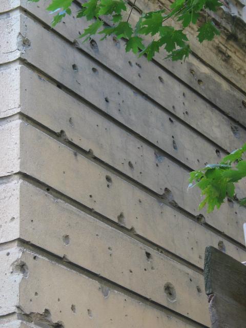
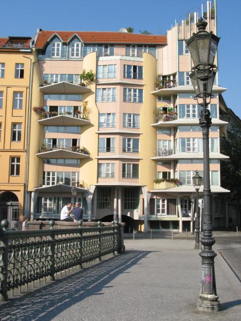
After the Wall (well, most of it) came down, and the two Germanys reunited, much of the former East Berlin looked just as it did after the war ended: bomb-damaged buildings and bullet-riddled walls like the one at the left below. Most of that is gone now, though, in a flurry of reconstruction that has changed the face of the city -- like the restored apartments along the Landwehrkanal, below at the right:
|
||
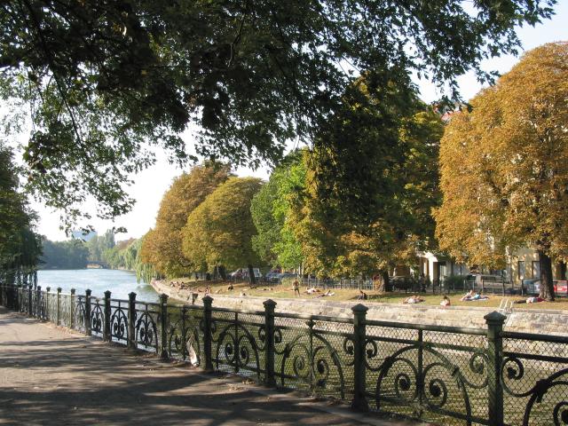
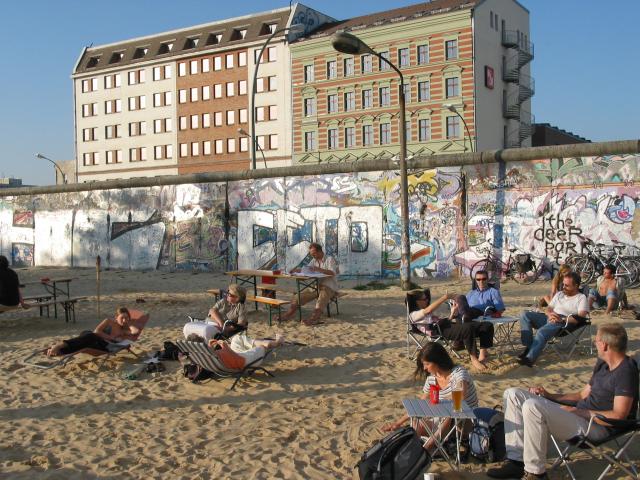
The Landwehrkanal, a canal running through Berlin, has peaceful walks -- and a beach alongside parts of it, too, where people were enjoying an Indian-summer afternoon. And, although life's stll no "beach" for a lot of the former East Berliners -- whose part of the city, and country, is still far different than what was the West -- they still make the best of it, like these people on a beach that's sandwiched between the Spree River and the former Wall.
|
||
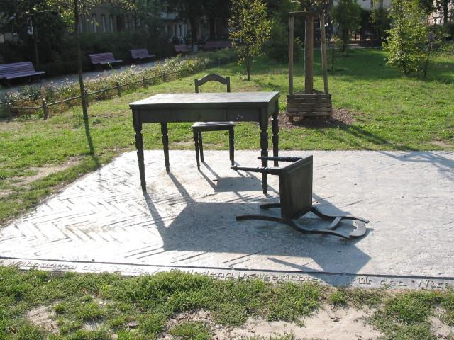
In the middle of all the signs of Berliners' resilience, though, are signs of their past troubles. The Nazis' racist and homophobic campaign to "purify" Germany (and Europe) meant that -- like the Communists would do later with their Wall -- Jewish families were torn apart. The memorial below left, in Koppenplatz, is to family members who were suddenly taken away -- by a knock on the door -- never to return to their homes. On the right are the two steel plates that cover the entrance to Hitler's bunker -- where he and his new wife Eva Braun killed themselves as the Russians closed in, just a kilometer or so away. There's no memorial there, no sign: the bunker is underneath a courtyard and a parking lot, next to a childrens' playground and some apartment blocks. If you suspect that Germans are hiding their history by "burying" Hitler in this way, though, I suspect that you're wrong. People here are all too aware of their past -- and, I think, are remembering it as they move on to make a better society. Berlin, especially, is that kind of place.
|
[Previous page: Lyme Regis,
England]
[Next page: Potsdamer Platz,
Berlin]
[Tour start: Around the World 2003]
[Tours]
(These photographs are Copyright © 2003 by Jerry Peek. Much higher-resolution versions of most images, and many other images too, are available at Jerry Peek Photography. Photos are available at reduced prices, or free, for non-commercial use.)