Photo Tour: Arctic Drive to Inuvik, Northwest Territories
In 1985, I wanted to take an amazing road trip — a monumental road trip. I grew up in the wide-open countryside of New Mexico, and I love the outdoors. What better way to get away than to go as far North as I could? The road to Prudhoe Bay, Alaska, wasn't open to the public then... and, besides, I'd always wanted to go to Dawson, a Gold Rush town in the Yukon. So, I thought, why not take the Dempster Highway (which had opened just a few years before, in 1979) all the way to the end at Inuvik in the Northwest Territories?
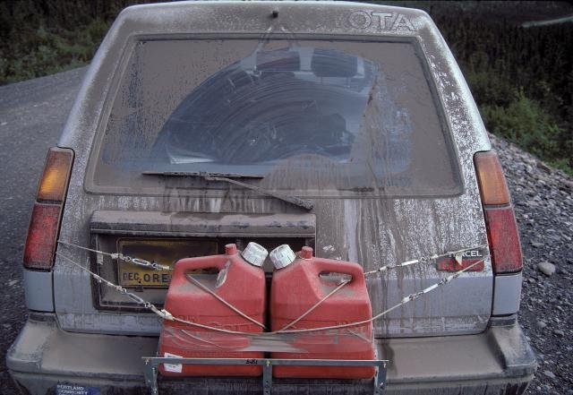
I had one of the great Toyota Tercel 4-wheel-drive station wagons (I miss that car...) with a big back bumper that would hold two 10-liter jugs of gasoline. (Gas stations are hundreds of kilometers apart up there... and the roads would be so empty that I was a lot more concerned about running out of gas than about someone rear-ending me and my gasoline jugs.) So I made a rack for the gas jugs (which I could install once I was up north — who knows if the Highway Patrol would have approved farther south?). I bought a copy of the indispensable Alaska Milepost for 1985 (now called just The Milepost — but which, then as now, also covered the Dempster and other roads I'd be on). I read as much as I could to get ready for a solitary journey (no one I knew was crazy enough to go with me :) and hit the road near the end of June, 1985.
The drive was easier than I thought it would be. I joined the Alaska Highway north of Prince George, BC, late in the evening (which is very late that far north). But the real adventure didn't start until I'd left the Alaska Highway at Watson Lake, Yukon — and especially until I filled up my gas jugs and put them on my bumper, as I got on the Dempster Highway just past "midnight" (in quotes because it was still bright outside). North, north, north...
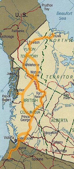
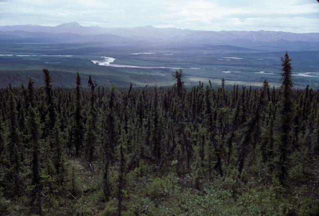
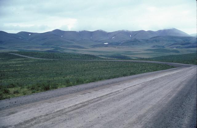
You can see my route on the map to the right and above. Northbound I took the eastern (right-hand) roads; on the way home I took the western roads. The farther north I drove, the fewer vehicles I saw, the shorter the evergreen trees were, and the more wild and exciting the landscape became. On my last 24-hour day northbound, I saw maybe ten vehicles... most of them at a ferry crossing near Arctic Red River.
This is a magnificent wilderness road that you should take if you can. I have no idea how it's changed in the twenty-plus years since I was there, but I'm sure it can't disappoint. Just plan, plan, plan... ask questions and think... you'll be far away from anything other than magnificent nature (and a slender thread of gravelled roadway). Let's go!
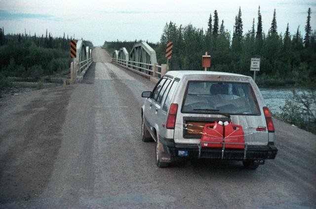
At the start of the Dempster Highway, the far-north road, just after "midnight":
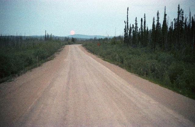
Moon setting at 1 AM:
Camping spot (I slept in my car, thanks to the 10,000,000,000,000 mosquitoes!):
Well after sunrise (5 AM or so):
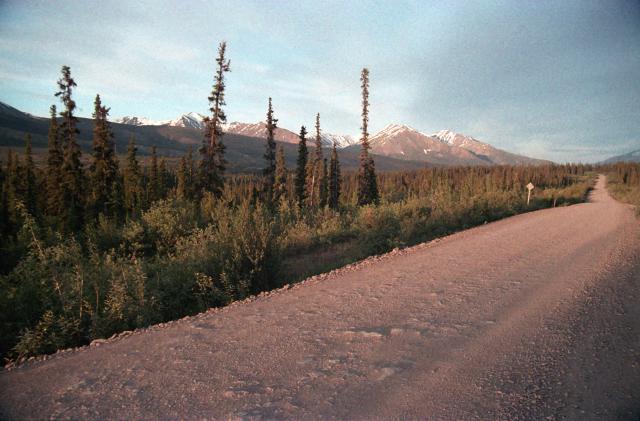
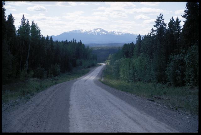
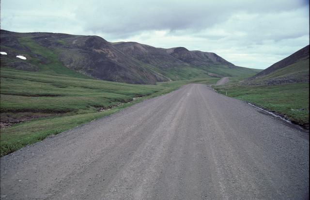
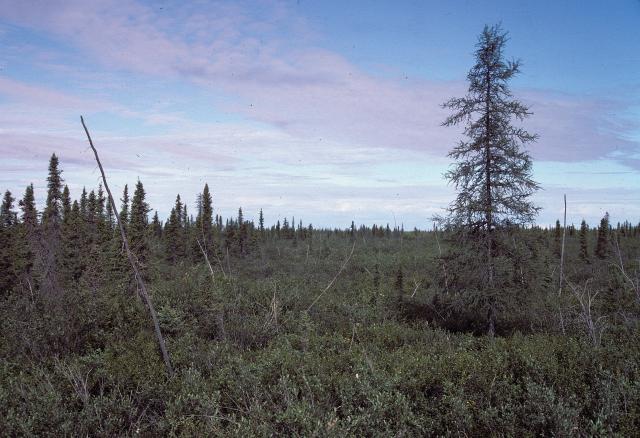
A couple of scenes along the way, as the evergreen trees get smaller and more scattered:
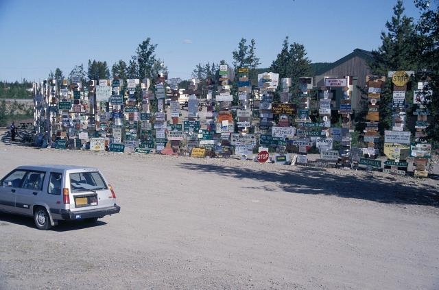
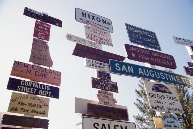
Watson Lake, Yukon is famous for its "sign forest", where people bring signs from their hometowns to post on the posts:
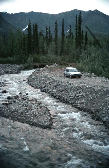
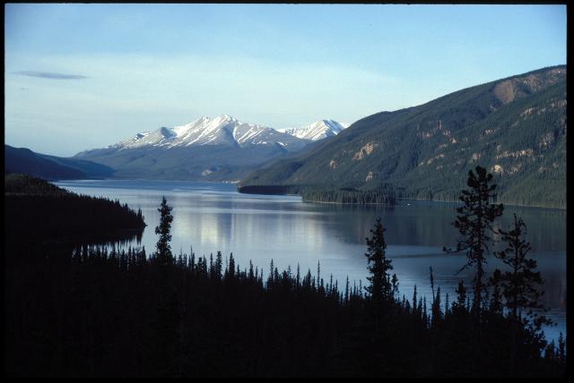
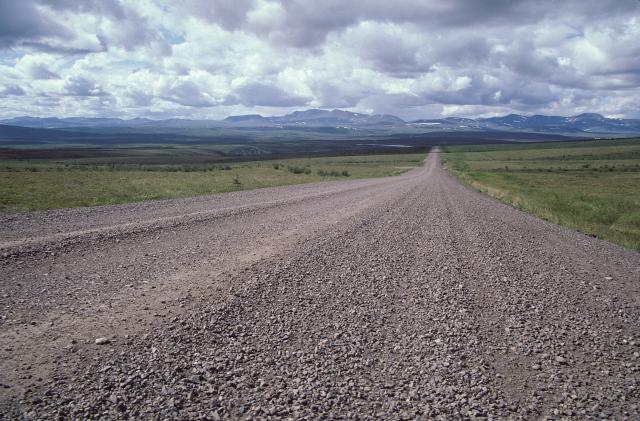
More shots on the road:
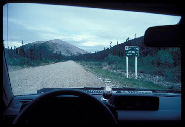
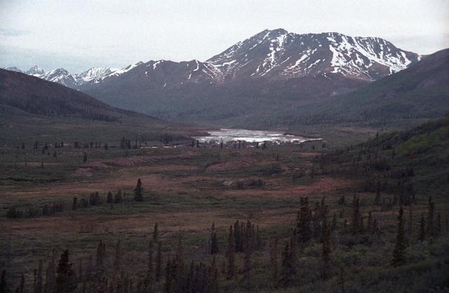
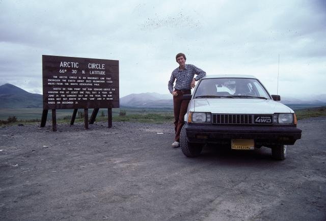
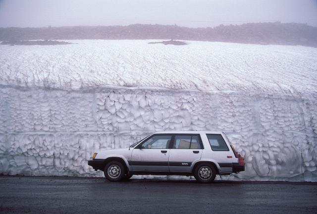
Crossing the Arctic Circle, then up over a pass (this is late June...):
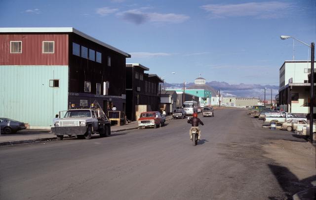
Inuvik is almost the farthest-north town. There's one farther north, Tuktoyaktuk, but the road there is only open in the winter (it's an ice road). This is Inuvik's main street:
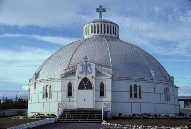
In the photo above, you can see this igloo-shaped church in the background:
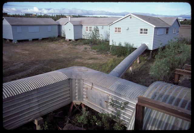
You can't build things on the ground because the ground will melt. So the buildings are on stilts, and the pipes run above-ground in heated "utilidors":
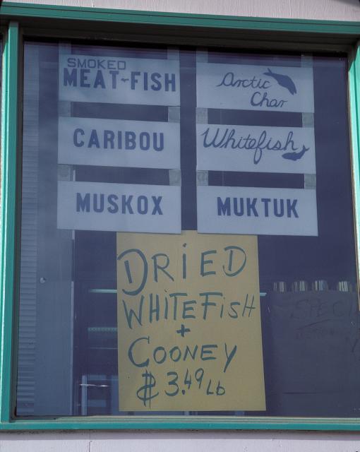
What's for lunch? (This is actually in the middle of the "night," so the store was closed):
I tried to camp there, but the bugs were nasty... I tried to sleep in the back of my station wagon (actually a cozy place!), but the sun was so hot (at 2 AM) that I roasted inside. So I headed south and eventually found a hillside with some shade. Notice the sunset colors in the clouds in this photo past midnight:
This airplane runway (!) doubles as a highway. Don't stop here, they warn...
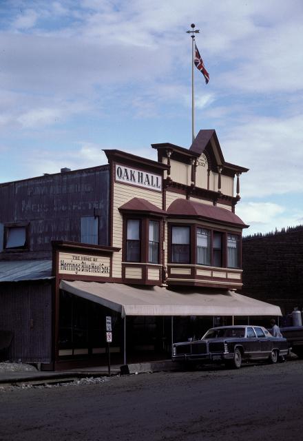
I'm finally in Dawson, Yukon, a gold-rush town restored and run (very well!) by Parks Canada:
A second-hand store:
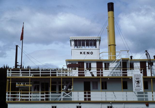
This is the S.S. Keno, a paddlewheel steamship with an interesting tour inside:
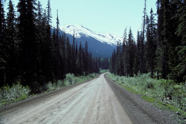
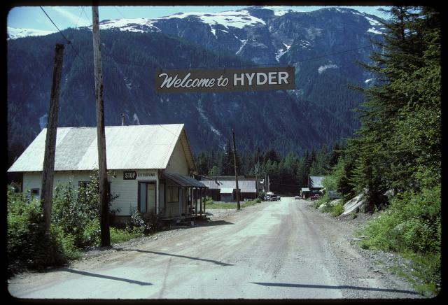
Near the Pacific coast in British Columbia is the Cassiar Highway. It runs through typical coastal evergreen forest. A spur branches off, goes right past a glacier (which, thanks to global warming, may not be there anymore...), and crosses into the tiny town of Hyder, Alaska:
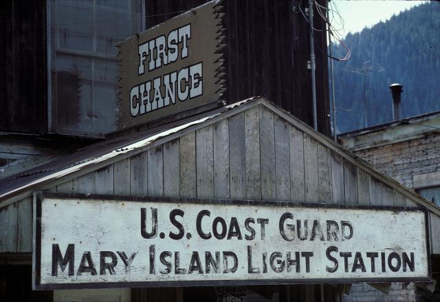
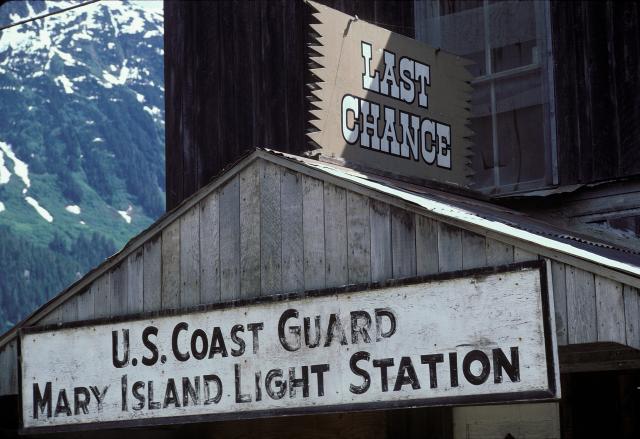
Besides the gorgeous scenery (when it's not raining, which it does a lot...), there's not much to do in Hyder except to get "Hyderized." That involves a visit to one of the bars lining the main street. Here's one of them (or is it two of them?) — in an old Coast Guard building. (I actually could tell that it was just one bar... I was driving on, so I didn't get Hyderized...)
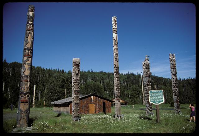
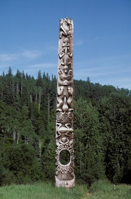
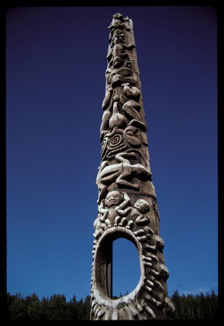
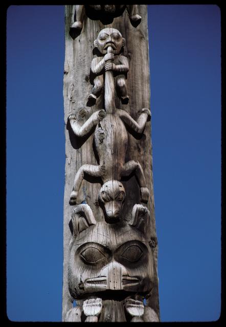
Down the road a ways is a native village, Kitwancool, that's famous for its totems. Here's a group shot, then a few shots of one pole closer and closer:
From here there was a lot more "civilization," so I didn't stop much. I got home to Portland (Oregon) a few days later.
If you'd like to see some of the other tours, please do.
(These photographs are Copyright © 2006 by Jerry Peek. Much higher-resolution versions of most images, and many other images too, are available at Jerry Peek Photography. Photos are available at reduced prices, or free, for non-commercial use.) The route map is from the US C.I.A., 1999, courtesy of the University of Texas Libraries, The University of Texas at Austin. edited with The GIMP.