Photo Tour: Up the Sani Pass to Lesotho
The kingdom of Lesotho (pronounced "luh-SUE-too") is on a high plain
-- a treeless plain, actually, because the people cut down all of the
trees.
Much of the topsoil has been lost to erosion.
In this part of the country, at least, the food (except for the meat
from the animals) comes from elsewhere. Up here, at almost 3,000 meters
(over 9,000 feet) elevation, it's cold. Heat comes from burning the
scrubby plants, in a unique system that keeps the round huts amazingly
warm (but also smoky)
inside.
Still, with the hardships, people here are generally happy, live long
lives, and have the highest literacy rate in Africa -- thanks to the
educational system, where parents teach those of their children who
don't go off to
school.
(The next school is far from Sani Pass -- 50 kilometers or so -- and
most people out here have no transportation other than taxis, animals, or their
own
two feet.
So kids who go to school go for the year, coming home only in the
summer.)
I didn't learn most of that firsthand:
I just rode along in the Land Rover and took some (actually, lots of)
photos!
All of that info came from my Lonely Planet guidebook,
and from the guide on the excellent half-day trip
with Major Adventures.
Getting to Lesotho over the Sani Pass
is
a major adventure -- a
short major adventure, anyway.
If you come from the western side (from South Africa, which surrounds
Lesotho) -- the way most people come in, I think --
you can drive straight to the country's capital on a paved road.
Then there are the nuts who come up the Sani Pass...
To get a larger version of any picture, click on it; a new window
should open. When you close that window, this window should still be
here.
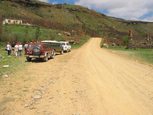
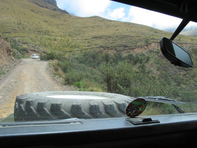
The Sani Pass is the only way to drive in and out of the eastern side of Lesotho. Until 1948, this was a donkey road, a trading route -- and a popular one, too, with as many as 2,000 donkeys making the week-long journey at any one time! That's when an enterprising Brit -- along with a huge and highly-motivated work crew from Lesotho -- built a jeep road, finishing the job in two weeks. The new road cut the journey time to hours instead of days, but it still took a rugged group of people to drive converted Land Rovers and other vehicles tough enough to handle the up-to-30% grade. (The South African border-crossing post has a bulletin board with hair-raising stories from those days. My favorite was of a driver who realized his truck was going off the edge. He jumped out in time. The Land Rover rolled off and far down, landing on its tires. He clambered down the cliff, got back in the Land Rover, started it up, and kept driving!) The trading post at the foot of the pass -- the ruins are shown in the left-hand photo below -- had a thriving business until fairly recently. The road has been improved enough that standard four-wheel-drive vehicles can make the trip now. (This isn't a road for inexperienced 4WD drivers, though.) The right-hand picture below is a telephoto shot, looking from the viewpoint where we stopped (which you'll see in the next set of photos) toward the top of the pass (that notch at the top of the zig-zag road). Impressive, eh?
|
||||
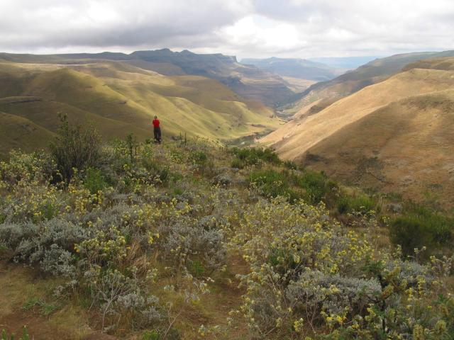
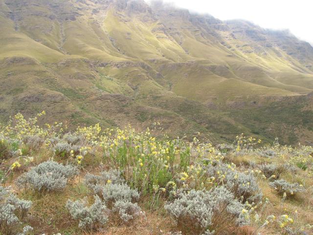
Our caravan stopped partway up the pass for dramatic views of the cloud-topped mountains and the valley streching out below (as well as of the road ahead, which you saw in the previous set of pictures):
|
||||
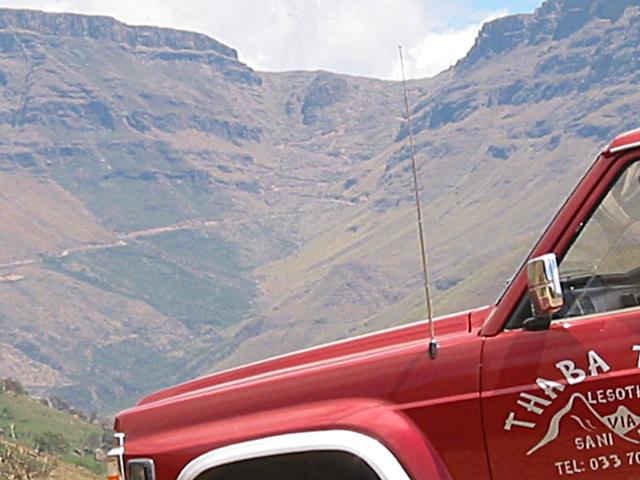
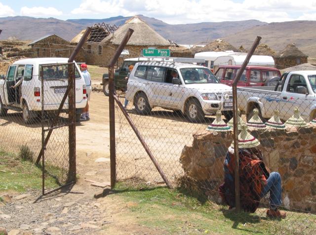
The left-hand photo below shows our Land Rover still on the "easy" part of the road. I wish I could show you the movies I took of the drive up the last -- and toughest -- part. (And I'm glad I was riding, not driving. I've done quite a bit of 4WD driving, but not very much like that.) The South African border post is near the foot of the pass. You don't actually cross into Lesotho until the top of the pass. That's where I took the right-hand photo: from inside the Lesotho border post, looking out at the crowd of 4WD vehicles coming and going -- and of a man selling local hats to the tourists:
|
||||
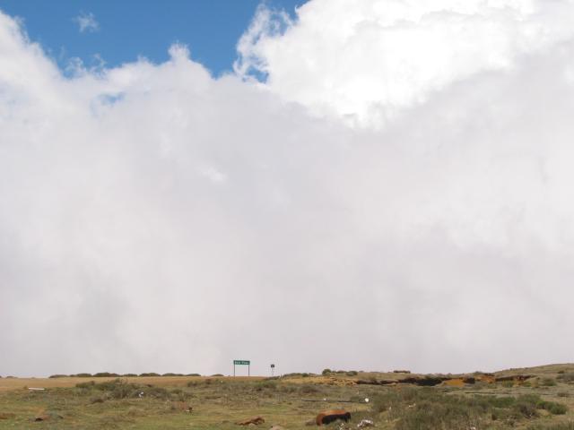
Once you get up here, after that long climb, one thing you notice right away is that the land is flat -- looking west, anyway. When you turn around and look east -- back where you came -- you see, well, this day all we could see was a wall of cloud. The clouds boiled up to the pass... and then simply vanished into the thin dry air. The left-hand photo shows the sign for the pass (with the steep drop just behind); the right-hand view is part of the village at the pass:
|
||||
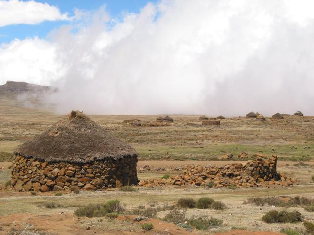
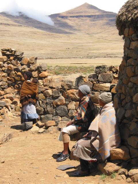
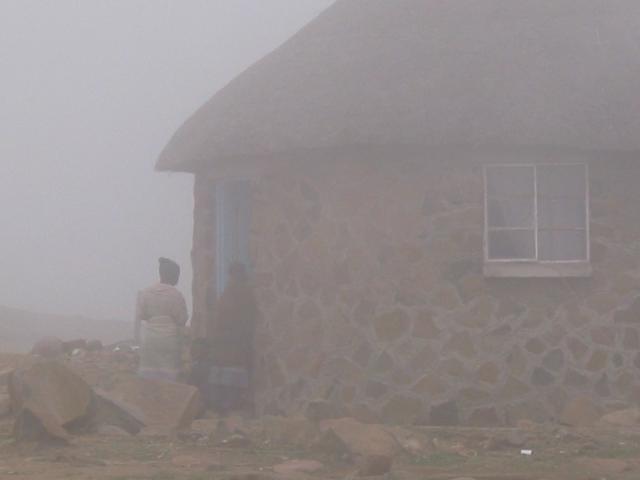
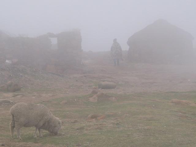
I wish I could show you photos of the Basuto people we visited. But, like the rest of my website, I don't show pictures of people without their (written) permission... so, if you'd like to see the people, you'll just have to ask me! The buildings (and the sides and backs of people, and people in the distance, and the land...) I can show, though. Here are a couple of those photos:
|
||||
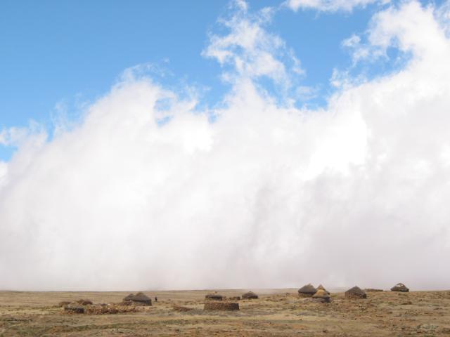
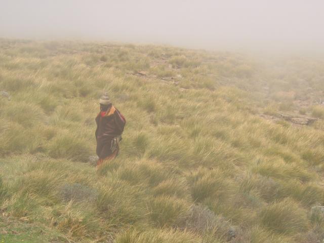
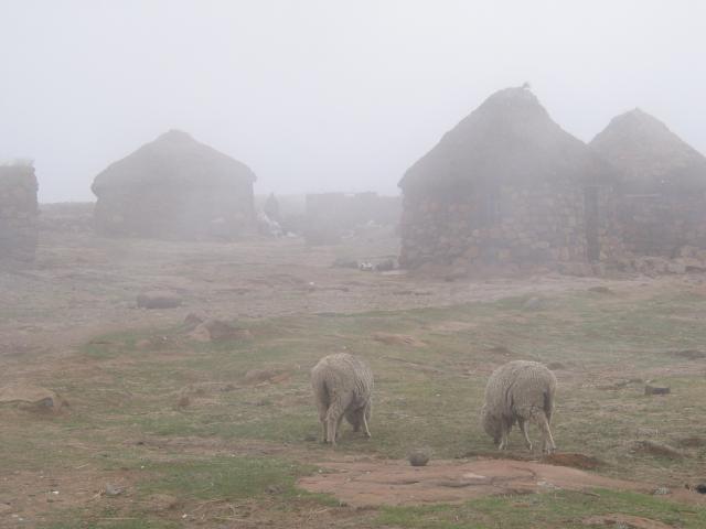
...and four more. While we had lunch (not with the locals, but at "the highest pub in Africa"), the wall of cloud started to come inland. By the time we finished, fingers of cloud were covering the village. The homes went in and out of shadow as I stood and watched (and felt the wind and the mist around me). It was quite a scene:
|
||||
Now I was even more glad that I'd taken that wrong turn, a couple of days before, and ended up in the Drakensberg! |
[Previous page:
Drakensberg Mountains, South Africa]
[Next page:
Glimpses of Guangzhou]
[Tour start: Around the World 2003]
[Tours]
(These photographs are Copyright © 2003 by Jerry Peek. Much higher-resolution versions of most images, and many other images too, are available at Jerry Peek Photography. Photos are available at reduced prices, or free, for non-commercial use.)