Photo Tour: Along the DMZ
DMZ stands for "Demilitarized Zone." It's a line along the Ben Hai river, at almost exactly the 17th parallel, which divided Vietnam into North and South. Ho Chi Minh's forces and the French agreed, in 1954, to set it up as a temporary boundary. But the DMZ divided Vietnam for more than 20 years. North and South Vietnam developed separately, with the North following communism and the South capitalism.
During the American War, the DMZ was anything but "demilitarized": some of the heaviest fighting took place here. Since 1976, when Vietnam was reunified, the old DMZ technically went away. But divisions remain. Vietnamese people still talk about "north" and "south." The old north, with its old capital Hanoi, is now the capital of all Vietnam -- and "southerners" I talked to didn't have much good to say about northeners.
I took a day-long tour to former military sites along the former DMZ. A lot of the phyisical evidence of the war is gone -- overgrown by jungle, replanted into fields, rebuilt from rubble. But there's still lots to see, including thousands (or millions) of bomb craters. There's also lots that you can't see, like thousands of mines still buried -- and still killing people. All in all, it's a sobering place that still brings back the horror of the war. I'll try to give you a feel for my day along the DMZ.
To get a larger version of any picture, click on it; a new window
should open. When you close that window, this window should still be
here.
At the risk of being too analytical, I'll start with a map, below, of the DMZ area. It's on the wall at the Khe Sanh museum. (If your screen can't show both this text and the map at the same time, you can click on the map to open it in a separate window.) The DMZ is the top-most white line running from left to right. It extends from the border with Laos (at the left, the west), across Vietnam, to the South China Sea (at the right, the east). A bit later I'll mention two other things on this map. (I wish I had a pointer...) Highway 9 is the red line that runs from near the bottom-left corner and the right-center -- between the Laotian border and the city of Dong Ha. The Ho Chi Minh Trail is the dotted line about a quarter of the way from the left border, running top to bottom (north to south). And (pay attention, class! :) Highway 1, the main north-south national highway, is the red line that parallels the coast. Okay, end of lesson. Ready for the tour? 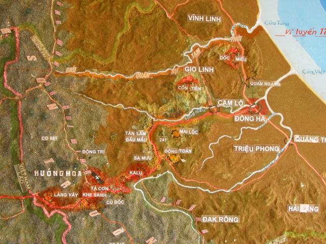 |
||||
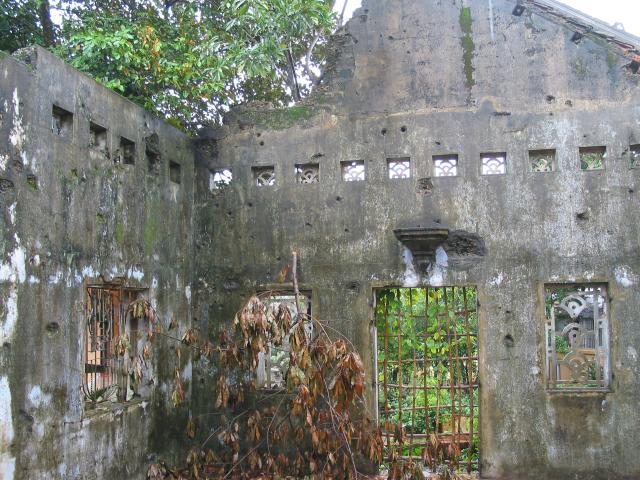
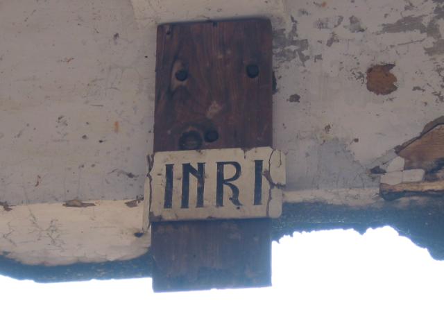
Our guide told us that some 20 million tons of explosives -- more explosive than both of the atomic bombs dropped on Japan -- were used on the area around this building. It used to be a church, although the only way to tell was this tiny sign on what used to be a beam across the ceiling:
|
||||
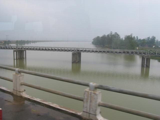
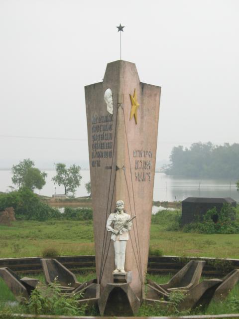
The famous bridge across the Ben Hai river used to be painted red on the north side and yellow on the southern half (though, our guide told us, there were other color schemes too). These days, it looks like any other bridge along National Highway 1. You can tell that it's the middle of the former DMZ by the monument that stands next to the bridge on the riverbank:
|
||||
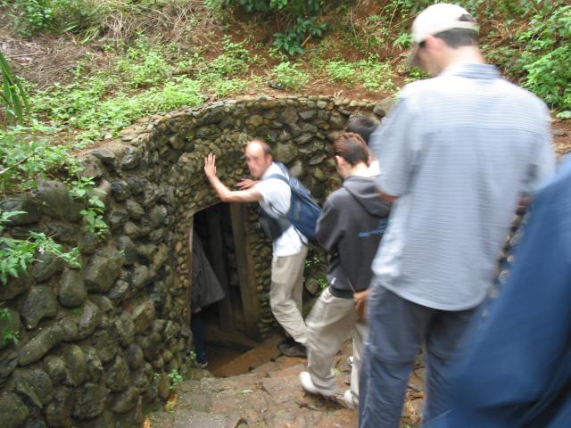
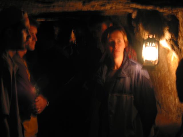
The DMZ wasn't an easy place to be during the American War. The North and South bombarded each other over and over again. To survive, villagers who lived here built underground tunnel complexes: 114 of them! Tunnels collapsed under bombardment, or naturally -- sometimes killing the people inside. One complex that survived is near the village of Vinh Moc. The tour that takes you through these claustrophobic passages -- as much as 25 meters (about 80 feet) underground -- gives you a good idea of the will to survive that the Vietnamese had. Tens of thousands of villagers lived down here for as many as five days at a time. Seventeen babies were born in the underground delivery room.As you walk farther and farther underground, you pass holes dug into the walls at the sides of the tunnels where families lived during the frequent bombardments. The photo at the right is in the central meeting room, the largest one we saw on the whole trip. That's the ceiling just above peoples' heads:
|
||||
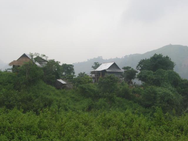
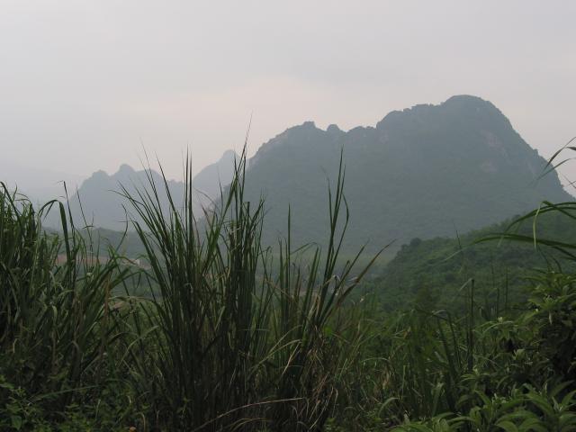
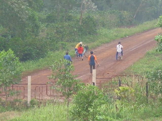
National Highway 9 follows the old DMZ, more or less. The land is mountainous and rural. Where there's room, you'll see fields and homes like the ones at the left below. Along Route 9 are a series of old US military bases and other sites. At the right below you can see the infamous hill called Rockpile -- and, behind it, another hill called Razorback. Rockpile is a 230-meter-high, well, pile of rocks. This was one of the bases along the "McNamara Wall" where Americans tried to stop the flow of arms and people from north to south. The famous Ho Chi Minh Trail (a network of old paths that's now being paved into a new national north-south highway) runs through the area too:
|
||||
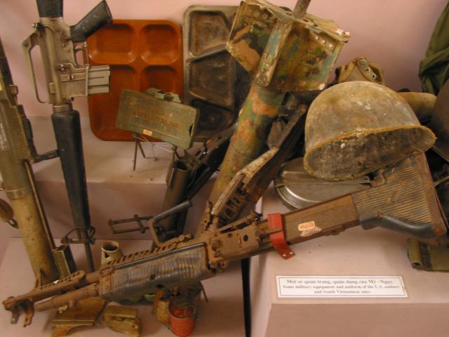
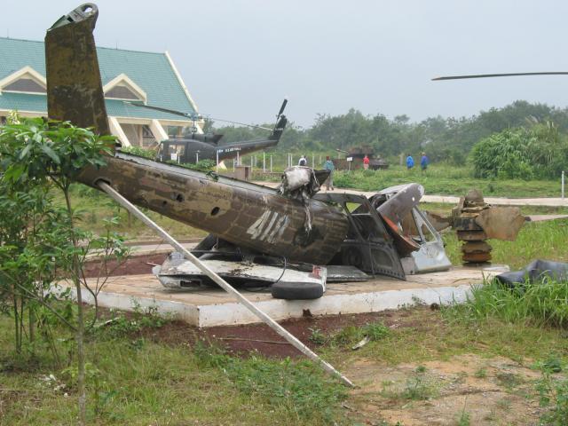
I mentioned that the map shown at the start of this tour came from the museum at Khe Sanh. That's where the US had a famous airbase. This was one of the most (in)famous battle sites of the war. To distract the Americans from the Tet Offensive that they were going to launch in the south, the communists started a siege of the base at Khe Sanh, here on the DMZ. US President Johnson, who was determined to avoid another disaster like the one the French suffered not long before at Dien Bien Phu, made the Joint Chiefs of Staff sign a written pledge that they wouldn't lose Khe Sanh. They didn't lose at Khe Sanh -- though the cost in human lives was terrible. And, as it turned out, the Tet Offensive -- for which Khe Sanh was just a smokescreen -- was the beginning of the end of the war. People have moved back into the DMZ area, thanks partly to free land that the government has given them. (The DMZ used to be a no-man's land.) All that's at Khe Sanh now are a memorial museum, a lot of military hardware, the outlines of the old airfield -- and, sadly, the unidentified (and still lost) remains of some of the people who died there. Our tour guide had led search parties and veterans who still come to the area to look for bodies or to connect with the terrible past here. If you go to the museum, be sure to page back through the visitors' book to see some of the moving comments written by people who fought here.
|
[Previous page:
Ngoc Son Temple, Hanoi]
[Next page:
Hue, Vietnam]
[Tour start: Around the World 2003]
[Tours]
(These photographs are Copyright © 2003 by Jerry Peek. Much higher-resolution versions of most images, and many other images too, are available at Jerry Peek Photography. Photos are available at reduced prices, or free, for non-commercial use.)